
Gwen253 viewsSep 12, 2026 at 02:59 AM
|
|
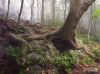
Tree Roots Cling to Boulder212 viewsIn cloud on Mount Rogers,
Rat's Birthday Hike, 2009Sep 12, 2026 at 02:59 AM
|
|

Pete's Branch Falls246 viewsHorse Creek Area,
3-8-2017Sep 12, 2026 at 02:59 AM
|
|

Hollow Tree236 viewsHollow tree near 'High Rocks'Sep 12, 2026 at 02:57 AM
|
|

Whitehouse Mountain Cliffs248 viewsRat Patrol and Melissa on one of the ledges.
Rocky Fork Area,
December, 2010Sep 12, 2026 at 02:57 AM
|
|

Cascades341 viewsSpruce Thicket Trail,
8-2011Sep 12, 2026 at 02:56 AM
|
|

Ascending Longarm Ridge246 viewsView of part of the lower Big Pine Ridge Knob (aka, 'the Volcano'), and the second Pine Ridge Knob ('the Pyramid') beyond that.
November, 2010Sep 12, 2026 at 02:56 AM
|
|

Jones Branch267 viewsthese falls are a tributary to Jones Branch.
Usually there is only a trickle of water (or less) coming out of that hollow, but heavy rains brought these falls to life. Sep 12, 2026 at 02:54 AM
|
|

Looking over at Embreeville Mountain213 views...from one of the ridge lines on Sampson Mountain,
August 2009Sep 12, 2026 at 02:54 AM
|
|
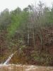
Flood Waters in Clarks Creek229 views2-23-2019Sep 12, 2026 at 02:54 AM
|
|

old hunter shack on top of Longarm Ridge217 views'Rat Patrol' chilling at the shack...1988 (?)
This shack is no longer there, btwSep 12, 2026 at 02:54 AM
|
|

Bear-Claws Marks213 views...on pine tree, on the ridge-top of Sampson Mountain,
August 2009Sep 12, 2026 at 02:52 AM
|
|
| 1530 files on 128 page(s) |
 |
|
|
|
|
28 | |
|
|
|
|


