|
Random files - Trail Pics |
 |
|

SIll Branch225 viewsComing out of South fork of Sill Branch after completing loop from Sill Branch Overlook...and losing Rat's backpack.
|
|

Another Large Boulder223 viewsJust below the Overlook Boulder,
Jones Branch, 3-19-2011
|
|

Watauga Lake224 viewsMean clouds over the lake
|
|

old hunter shack on top of Longarm Ridge212 views'Rat Patrol' chilling at the shack...1988 (?)
This shack is no longer there, btw
|
|

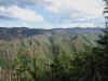
View From Sill Branch Overlook213 viewsViews of North Fork Sill Branch and the 'Meatgrinder' ridge top where we are heading, trying to loop over and come down the other side by upper falls.
|
|

Barbed Wire220 viewsTree affected by barbed wire,
Bald Mountain Trail,
July, 2011
|
|

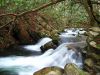
Cascades On Sill Branch309 views3-11-11
|
|

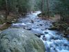
Cascading Rock Chute232 viewsLong cascades on Sill Branch,
3-11-2011
|
|
|
Last additions - Trail Pics |
|
|

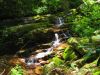
Cascades365 viewsCherokee National Forest
12-14-20Dec 29, 2020
|
|

Cascades, February 2020271 viewsJun 23, 2020
|
|

Cascades, February 2020247 viewsJun 23, 2020
|
|

Cascades, February 2020223 viewsJun 23, 2020
|
|

Slide, February 2020210 viewsJun 23, 2020
|
|

Cascades, February 2020212 viewsJun 23, 2020
|
|

284 viewsMar 27, 2019
|
|

282 viewsMar 27, 2019
|
|
|
Last viewed - Trail Pics |
|
|

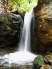
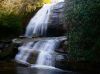
Wilderness Falls211 viewsOctober, 2009Jul 25, 2026 at 07:29 AM
|
|

219 views...near High Rocks, NC
May, 2010Jul 25, 2026 at 07:27 AM
|
|

view from High Rocks on the AT228 viewsLooking down off the rocks towards Spivey Gap.Jul 25, 2026 at 07:26 AM
|
|

Lower Wilderness Falls207 viewsOctober 2009Jul 25, 2026 at 07:21 AM
|
|

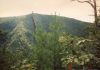
View From Longarm Ridge244 views'The Pyramid' and the Devil's Forks,
1-1-2010Jul 25, 2026 at 07:20 AM
|
|

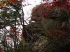
Gnarly203 viewsJul 25, 2026 at 07:19 AM
|
|

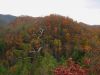
View From Turkey Pen Cove Trail257 viewsLooking toward Coldspring Mountain/'Big Butte'.
12-3-2011Jul 25, 2026 at 07:17 AM
|
|

Buffalo Mountain View208 viewsView to Southeast from White Rock Cliffs,
June, 2010Jul 25, 2026 at 06:36 AM
|
|
|