Album list
Last uploads
Last comments
Most viewed
Top rated
My Favorites
Search
Home
|
Login
-
Home
>
Trail Pics
>
Sampson Mtn. Wilderness Area
FILE 818/1530
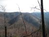
'The Pyramid'
...and the connecting 'landbridge' as seen from Big Pine Ridge Knob #1 ('the Volcano'). Sill Branch is on the left, Devil's Fork on the right.
January 2010
Rate this file
(No vote yet)
Javascript must be enabled in order to vote
File information
Filename:
Big_Pine_Ridge19.jpg
Album name:
boldar
/
Sampson Mtn. Wilderness Area
Filesize:
293 KiB
Date added:
Feb 06, 2010
Dimensions:
1000 x 750 pixels
Displayed:
282 times
URL:
http://www.guitar-antics.com/trailstealth.com/gallery/displayimage.php?pid=2449
Favorites:
Add to Favorites