
Tree In Clouds237 viewsBald Mountain Trail,
July, 2011Nov 14, 2026 at 05:09 PM
|
|

Buckeye Falls289 viewsOld Old Photo
Photo by RatNov 14, 2026 at 05:08 PM
|
|

High Rocks along the AT257 viewsNov 14, 2026 at 05:08 PM
|
|

Jones Branch Overlook238 viewsViews from cliff...looking down on the Appalachian Trail from the overlookNov 14, 2026 at 05:08 PM
|
|

Picnic Grounds250 viewsPhoto by Lisa Lemmons-PowersNov 14, 2026 at 05:08 PM
|
|

View From Longarm Ridge249 viewsThe Longarm Valley...
November, 2010Nov 14, 2026 at 05:08 PM
|
|

Longarm Ridge 249 viewsView of the Longarm Ridge and the Longarm Valley.
November, 2010Nov 14, 2026 at 05:08 PM
|
|

Camp Creek Falls239 views3-7-2015Nov 14, 2026 at 05:08 PM
|
|

226 viewsphoto by Becky HyderNov 14, 2026 at 05:08 PM
|
|
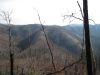
'The Pyramid'292 views...and the connecting 'landbridge' as seen from Big Pine Ridge Knob #1 ('the Volcano'). Sill Branch is on the left, Devil's Fork on the right.
January 2010Nov 14, 2026 at 05:08 PM
|
|

Longarm Ridge319 viewsThe 'trail' on Longarm Ridge Top.
November, 2010Nov 14, 2026 at 05:08 PM
|
|

Views from Big Pine Ridge258 viewsThe 'Volcano' ridge leading up to the right, Longarm Ridge to the left, and Sampson Mountain behind them all.
January 2010Nov 14, 2026 at 05:08 PM
|
|
| 5760 files on 480 page(s) |
 |
|
|
|
|
316 | |
|
|
|
|


